Aswan High Dam: What It Changed and Whether to Stop
The Aswan High Dam is one of the largest engineering projects of the twentieth century and one of the least rewarding half-hours in a southern Egypt itinerary. It reshaped the Nile, ended the annual flood, drowned Nubia and forced the rescue of Abu Simbel and Philae. Almost none of that is visible from the viewing platform, which is why it needs explaining before you stand on it.
What exactly is the Aswan High Dam?
The Aswan High Dam sits a few kilometres upstream of Aswan, above the older dam the British finished in 1902. It is not a concrete wall. It is an embankment: close to four kilometres of rock and clay piled across the Nile, about 110 metres high, with a road running along the top. Construction ran from 1960 to 1970. Standing on it, the main sensation is width rather than height.
The politics are more interesting than the structure. American and British funding was withdrawn in 1956; Nasser nationalised the Suez Canal in response, and the Soviet Union supplied the money and the engineers. The dam became the physical statement of an independent Egypt. That history also explains the lotus-shaped Egyptian-Soviet Friendship Monument on the western bank, which is otherwise inexplicable to anyone arriving cold.
Two of those numbers are worth carrying up onto the crest. Close to four kilometres means crossing it by vehicle takes minutes rather than seconds, and that the top is wide enough to carry a road, a viewing area and a car park without any of it feeling like a structure at all. Ten years of construction means the dam was rising at exactly the moment the temples behind it were being cut into blocks and moved, which is the part of the timeline most visitors have never put together.
Why it was built here and nowhere else
The reason is geological. North of Aswan the Nile runs through sandstone and, further north, limestone, across a broad floodplain with nothing hard to build against. At Aswan it hits granite, and the rock breaks the river into channels around islands. That is the First Cataract. It gives a dam what a dam needs: solid rock on both banks, a defined point at which to close the river, and a long valley upstream deep enough to hold what you stop.
The ancients read the same line the same way. The First Cataract was Egypt's southern frontier for most of antiquity, the town on Elephantine Island was the border post, and a Nilometer cut into the rock there gauged the annual flood, because everything downstream depended on how high the water came. Two dams and four thousand years later, the modern state chose the identical spot for the identical reason. That continuity is more interesting than the embankment itself.
The granite explains one more thing you will probably see the same morning. The unfinished obelisk lies a few minutes away in the old quarries inside modern Aswan, because this is where the hard stone was. The obelisks at Karnak, the granite colossi and the sarcophagi inside the pyramids all came from here and travelled downriver, in some cases the better part of a thousand kilometres. The rock that made the dam site possible is the rock the ancient quarrymen were after.
The old dam and the High Dam are not the same structure
This is the single most common confusion in Aswan, and it is the tour operators' fault rather than yours. There are two dams. The old Aswan Dam, finished by the British in 1902 and raised twice afterwards, is a masonry wall a few kilometres downstream, and you cross it by road. The High Dam is the much larger earth-and-rock embankment upstream, built between 1960 and 1970. A morning excursion frequently crosses both without anyone saying so.
Telling them apart on the day is easy once you know. If you are driving over something that reads as a wall, with the drop visible below you, that is the 1902 dam. If you are on a broad bank of rock and clay and can barely tell you are on a structure at all, that is the High Dam. The jetty for the Philae boat sits between the two, which is why the dam is on your itinerary whether you stop on it or not.
The old dam also matters to the story of Philae. Once it was finished in 1902 the temple stood partly underwater for much of each year, and visitors rowed between half-submerged columns. Each raising of the old dam pushed the water higher. The High Dam would have finished the job and left the island permanently drowned, which is why the salvage operation happened when it did rather than sixty years earlier.
What did the dam actually change?
For thousands of years the Nile flooded every summer, and Egyptian life was organised around it. The dam ended that. Water is now held in Lake Nasser and released on demand, which means two or three crops a year instead of one, and land reclaimed from desert. It also means storage across years: the reservoir absorbed dangerous floods in the mid-1970s and in 1988, and carried Egypt through the drought years of the 1980s.
Behind the dam, Lake Nasser stretches roughly 500 kilometres south, crossing into Sudan where it is called Lake Nubia. The power station runs twelve turbines and produces around 2,000 megawatts. In the mid-1970s that was something like half of Egypt's electricity. National demand has grown enormously since, so the dam's share today is small. It remains, above all, a water-control structure rather than a power project.
The cleanest way to state the change is this. Before 1970 the amount of water Egypt had in any given year was decided in Ethiopia and East Africa, months earlier, and the country found out when the river arrived. After 1970 it is decided at a control room at Aswan. That is an enormous shift in who holds the switch, and it is the reason the dam is treated as a national achievement rather than an item of infrastructure.
Lake Nasser: what is actually behind the wall
From the crest the reservoir is enormous and featureless. Photographs of it disappoint in a specific way: there is nothing in the frame to give it scale, so a body of water 500 kilometres long comes out looking like any other lake on a bright day. What you are really doing is standing at the switch rather than looking at a view, and the sooner you accept that the better the half hour goes.
It is a working reservoir and not scenery. It absorbs floods, it releases through the year, it buffers low-Nile years, and it loses a great deal of water to evaporation, because a lake of that size lying open in one of the hottest and driest places on earth cannot do otherwise. That evaporation loss is permanent and it is the price of holding the flood in the desert rather than letting it run to the sea. It is also a fishery: the fish on an Aswan menu often comes out of this water.
There are boats on it, though very few. Lake Nasser cruises run between Aswan and Abu Simbel, usually three or four nights, calling at the Nubian temples that were moved when the lake filled: Kalabsha, Wadi es-Sebua, Amada. Traffic is light enough that you may pass two other boats in a day. It is a separate trip from a Nile cruise, which works the river north of the dam, and its appeal is that you arrive at the temples from the water rather than from a car park.
What did it cost?
The old flood carried silt as well as water. That silt fertilised the fields and rebuilt the Delta every year. It now settles in Lake Nasser instead. Egyptian agriculture runs on manufactured fertiliser as a result, which costs money and energy. The Mediterranean coast, no longer resupplied with sediment, erodes; salt water pushes further inland; and offshore fisheries suffered when the annual pulse of nutrients stopped.
Perennial irrigation also raised the water table under the fields, and under the monuments. Groundwater draws salt up into ancient stone, which is why you see drainage works around temples at Luxor and Karnak. Year-round canals helped spread schistosomiasis. The honest summary is that Egypt bought reliable water and lost a functioning natural system, and both halves of that sentence are true at the same time.
Salt is the recurring theme in all of it: building up in soils that are watered all year and never flushed by a flood, working its way into temple foundations, creeping inland from a coast the river no longer pushes back against. None of these is dramatic on any particular day, which is exactly why they were easy to discount in 1960 and hard to undo now. The dam did not remove the Nile's problems. It exchanged them for a slower set that arrives without a season.
What happened to the Nubians?
The reservoir drowned the Nubian homeland, a long stretch of river villages between Aswan and the Sudanese border. Something like a hundred thousand people were moved in the 1960s, though the counts vary between sources, roughly half in Egypt and half in Sudan. Egyptian Nubians were resettled near Kom Ombo, on irrigated land north of Aswan. Sudanese Nubians went east to Khashm el-Girba. The town of Wadi Halfa went under entirely.
The new villages were built to a plan, away from the river, in a landscape with nothing in common with the one people had left. Nubian language and identity survived. Nubian communities on Elephantine island and the west bank at Aswan are now part of the tourist circuit, sometimes in a staged way. The Nubian Museum in Aswan handles the displacement seriously and is the better hour.
It is worth knowing that the 1960s move was not the first. The old dam downstream was raised twice after 1902, and each raising pushed the water further south and emptied villages that had already been rebuilt once. By the time the High Dam filled, families in that stretch of river had been displaced repeatedly inside a single lifetime. None of that is mentioned anywhere on the crest, and none of it is visible from it, which is the honest limit of what a viewing platform can do.
How were Abu Simbel and Philae saved?
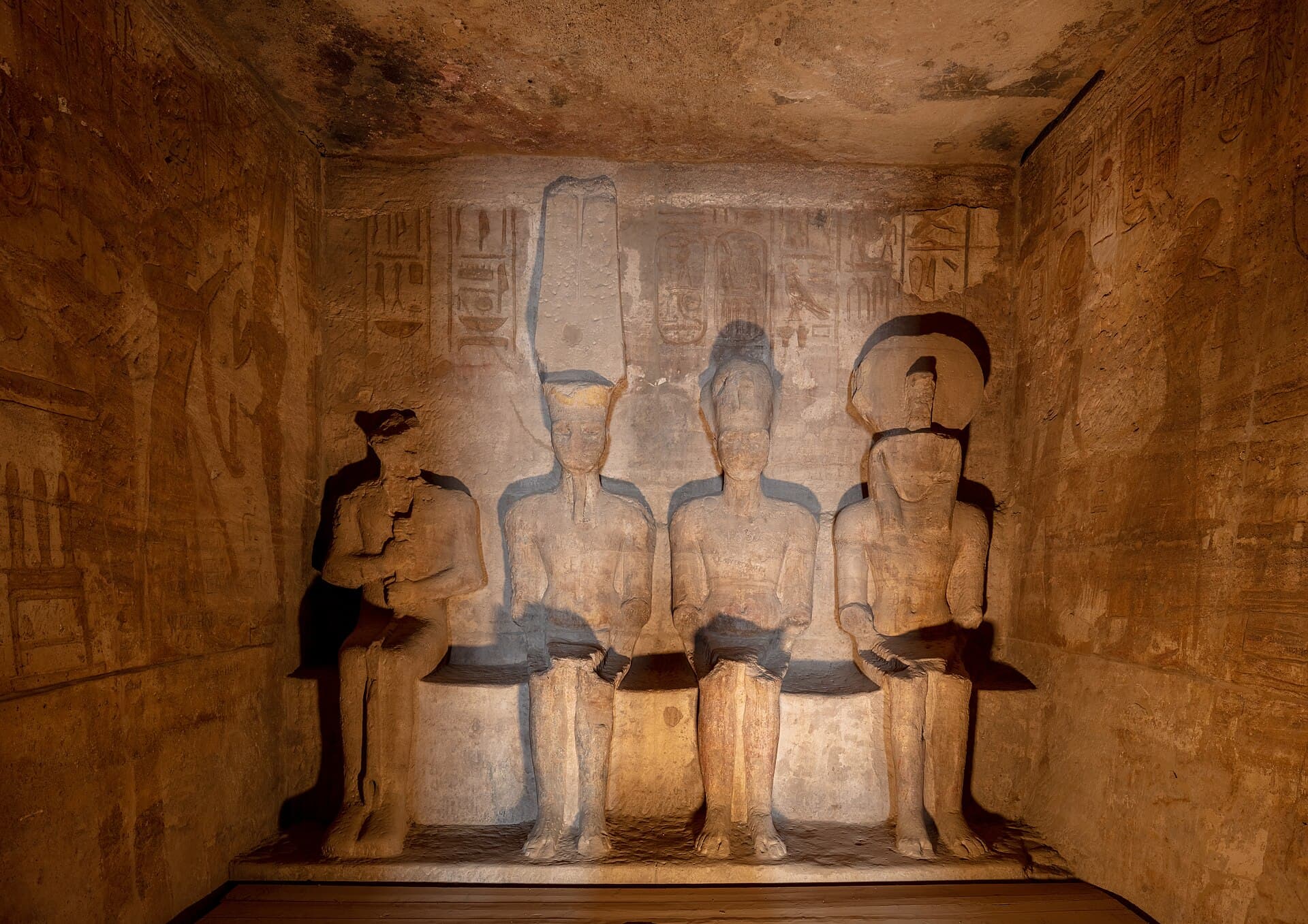
The rising water threatened dozens of monuments, and UNESCO ran a salvage campaign from 1960. Abu Simbel was cut into blocks between 1964 and 1968, lifted about 65 metres higher and set back around 200 metres onto an artificial hill built to imitate the original cliff. Philae had a different problem: it stood between the two dams and had been under water for much of each year since 1902.
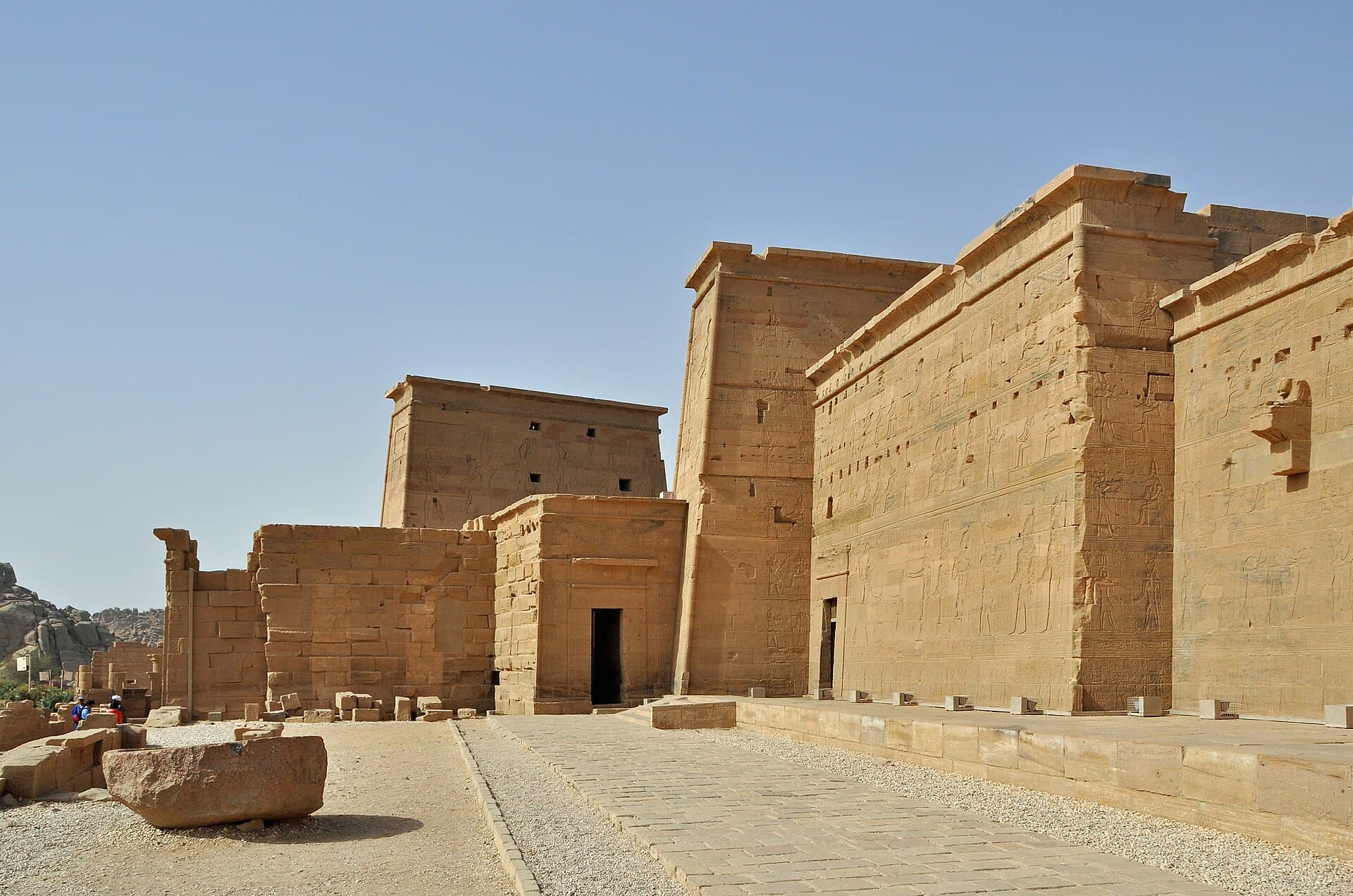
Philae was moved to the neighbouring island of Agilkia through the 1970s, finishing in 1980, after a coffer dam was built and the water pumped out. Kalabsha, Beit el-Wali, Wadi es-Sebua, Amada and others were relocated too. Four temples went to countries that helped: Dendur to New York, Debod to Madrid, Taffa to Leiden, Ellesiya to Turin. Very little Nubian architecture now stands where it was built.
The evidence is visible at both sites if you know to look for it. At Philae, faint saw lines run through the masonry and the lower courses of some walls carry a pale band where decades of standing water stripped the colour out of the stone. At Abu Simbel, the joins run across the statues once you have noticed the first one, and the cliff behind the facade is concrete and rubble under a skin of sandstone. Seeing the dam first turns those marks from oddities into the point.
Kalabsha and the temples at the western end
Kalabsha is the one relocated temple within reach of the dam itself. It was moved from its Nubian site to a promontory near the western end of the High Dam, along with Beit el-Wali and the Kiosk of Qertassi, and it is a genuine temple rather than a fragment. It is also, most days, empty, which is a condition Philae never achieves and a useful thing to experience once on an Egyptian trip.
Getting there normally means hiring a motorboat at the landing. Boatmen set their own terms, so agree the price and the waiting time before you step aboard rather than afterwards, and confirm on the day that access is open, because it is not guaranteed. That negotiation is most of the reason itineraries leave Kalabsha out, and the reason it stays quiet is the same reason.
Whether to do it comes down to how many hours you have in Aswan. On a standard half-day it does not fit, and it should certainly not come out of Philae's time. On a second day in Aswan, or for anyone who has developed an interest in the salvage campaign rather than the temples in general, it is the best available follow-up to standing on the dam. It puts a rescued building and the structure that made the rescue necessary within sight of each other.
How the dam explains the rest of your itinerary
This is the real case for the stop. Philae stands on the wrong island because of this embankment. Abu Simbel sits inside an artificial hill because of it. The temples in New York, Madrid, Leiden and Turin left Egypt because of it. If you have come up the river from Luxor, you have already been looking at the consequences for several days without necessarily being told what caused them.
It reaches further north than that. The drainage works you see around the temples at Luxor and Karnak exist because perennial irrigation raised the water table and salt began climbing into the stone. The fields you watched from the deck, growing two or three crops in a year rather than one, are the dam. So is the fertiliser being spread on them, since the silt that used to do the job is now sitting on the floor of Lake Nasser.
And the Nubian villages you may have been shown on Elephantine or the west bank connect straight back to this crest, as do the resettlement villages near Kom Ombo that most itineraries drive past without comment. Being told all this in a minibus does not land. Standing on the thing that did it does, which is why the half hour is worth having even though the view is not.
Is the dam itself worth visiting?
As a sight, not really. The visit is a stop on the crest: lake on one side, the river and power station on the other, a viewing area, a few souvenir stalls, and twenty to thirty minutes of standing in the wind. There is no exhibition to speak of, nothing to walk through, and no access to the machinery. Nobody comes away moved by the view.
It is still worth the stop, because it is already on the road to Philae's jetty and to Abu Simbel, and because the geography makes sense once you have seen it. What it is not worth is a dedicated excursion, a premium added to a tour price, or an hour taken away from Philae. Its value depends almost entirely on having somebody there who can explain what you are looking at.
There is one further argument in its favour, and it is a modest one. This is the least demanding thing you will do all morning. The crest is flat, the viewing area is a few steps from where the vehicle stops, there is no ticket queue of any length and nothing to climb. On a day that also involves the ramps and steps at Philae and a hot trench at the obelisk, half an hour that asks nothing of your knees has a value of its own.
What to look at while you are standing on it
Orient yourself first, because nothing on site will do it for you. The reservoir is on the upstream side, southwards; the river, the power station and the road back to Aswan are on the downstream side, northwards. Water leaves the lake through the works below you and reaches the turbines, and everything between here and the Mediterranean depends on how much of it is let through today. That sentence is the whole visit.
Then find the lotus tower at the western end. That is the Egyptian-Soviet Friendship Monument, five tall concrete petals marking the Soviet role in funding and engineering the project after the Western money was withdrawn in 1956. It is visible from the length of the crest. Whether visitors can go up varies and it is closed more often than it is open, so treat it as something to look at rather than something to plan around.
Finally, look north, downstream, towards the town and the old dam, and note how little of the structure under your feet you can actually perceive. That is the honest character of the place: an embankment so wide it reads as landscape. There is nothing labelled here, no interpretation and no exhibition, so if nobody is travelling with you who can explain it, read the story before you get out of the vehicle rather than after.
How do you visit it well?
Treat it as a working strategic site, because it is one. There are police posts at both ends, identity checks happen, and your passport should be with you rather than back at the hotel. Photograph the lake, the sluices and the friendship monument. Do not photograph checkpoints, guard posts or soldiers. The rules tighten and loosen without notice, so ask your driver what is allowed on the day.
There is an admission charge for the viewing area. Whether it is already covered varies by operator, so check before you leave Aswan rather than arguing at the barrier. Bring water and a hat, because there is no shade at all. The wind off the lake is constant and stronger than people expect, which matters when you are holding a hat, a hood or a lens cap.
Agree the timing before you set off, and hold to it. The usual failure on this stop is not too little time but too much: the group drifts towards the stalls, twenty minutes becomes fifty, and the lost half hour comes out of Philae at the end of the morning rather than out of the dam. Say in advance that this is a thirty-minute stop and that anything saved goes to the island.
How the stop fits into a cruise itinerary
Most Nile cruises finish in Aswan, and most passengers fly out on the morning the boat docks for the last time. Their Aswan is a rushed Philae stop wedged between disembarkation and the airport, and in that version the dam is the first thing that should be cut, because there is no spare half hour to spend on a viewing platform when the temple itself is being done in forty minutes.
The stop earns its place on a morning that was already built around Philae with time to spare, which in practice means a morning that starts from a hotel in Aswan rather than from a departure lounge schedule. That is the strongest argument for adding a night after the cruise: it converts a scramble into a proper half-day, and it buys back the late afternoon on the water that cruise passengers almost never get.
If you are coming the other way, sailing north from Aswan to Luxor, the dam usually lands on the first morning, before you board. The same rule applies. It is worth half an hour on the way to Philae and nothing at all as a separate item, and the time to protect is the temple's, not the embankment's.
What should you combine it with?
The standard Aswan half-day is the unfinished obelisk, the High Dam and Philae, and that order works. The obelisk lies in the old granite quarries in town: a single abandoned block close to 42 metres long, cracked before it could be freed, and the clearest surviving evidence of how the Egyptians cut stone. It carries no inscription, so the usual link to Hatshepsut is inference rather than proof.
Give the obelisk half an hour, the dam half an hour, and Philae at least ninety minutes, because Philae is the reason the morning exists. Kalabsha, the relocated temple near the dam's western end, usually needs a separate motorboat and is left out of most itineraries, which is exactly why it stays quiet. Book the morning in that order and nothing gets rushed except the dam, which can take it.
If you have a second day in Aswan, the additions worth making are not on the dam road at all. The Nubian Museum in town covers the history the crest omits, seriously and in air conditioning, and takes about an hour. A felucca out to Elephantine Island in the late afternoon is the thing most people actually remember about Aswan, and it uses the hours when the sites are unbearable anyway. Neither takes anything from the dam, because the dam needs nothing.
Who should skip it, and what to do instead
Skip it if your days in Egypt are few enough to count on one hand, if you are passing this way in the middle of the day between May and September, or if you have no guide and no particular interest in twentieth-century engineering. In the last case the stop reduces to a windy car park with a view of a lake, and the honest thing to say is that it will not repay the thirty minutes.
Children get very little out of it. There is nothing to climb, nothing to walk through, no machinery to look at and no exhibition, and the wind and the absence of shade make standing about unpleasant rather than merely dull. Twenty minutes is generous. If the morning is being planned around young travellers, the boat ride to Philae and the island itself will do far more work.
What to do with the time instead is easy. More of it at Philae, which needs at least ninety minutes and rarely gets them. The Nubian Museum, which is the better hour and covers what the crest leaves out. The quarry at the unfinished obelisk, early, before the granite heats up. And if you want the lesson without the stop, take the view from the Philae motorboat: the reservoir tells you what the dam did, and the temple on a rebuilt island tells you what it cost to save one small piece of what it drowned.
When should you go, and what do people get wrong?
Aswan is the hottest stop on a normal Egypt route. November to February is comfortable, March and October are warm but workable, and May to September is genuinely punishing, regularly above 40°C, with no shade anywhere on the crest. Go early in the morning in any month. The light is better, the coaches have not arrived, and you avoid standing on an exposed embankment in the middle of the day.
The common mistakes: confusing this with the 1902 dam and wondering why it looks like a bank of rubble; expecting a visitor centre; giving it an hour it does not deserve while rushing Philae; and pointing a camera at security. The largest mistake is treating it as a monument. It is not one. It is the explanation for everything else you have seen along the river, which is a better reason to stop than the view is.
Held against the rest of a southern Egypt itinerary, the dam occupies an odd position: the most consequential structure on the river and the least rewarding half-hour on the route. Both statements are true, and keeping them in mind at once is the whole skill of the stop. Arrive knowing what it did, stay thirty minutes, and give the rest of the morning to the island it very nearly drowned.
Common questions
Is this the same as the old Aswan Dam?+
No. The old Aswan Dam, finished by the British in 1902 and raised twice afterwards, sits a few kilometres downstream and is a masonry wall you cross by road. The High Dam is the much larger earth-and-rock embankment upstream, built in the 1960s. Tours often cross both without saying so, which is where most of the confusion comes from.
How long do you need at the Aswan High Dam?+
Twenty to thirty minutes, and that is the entire visit. It is a stop on the crest with a viewing area and a few souvenir stalls, no exhibition, nothing to walk through and no access to the machinery. Anything longer is time taken from Philae, which needs at least ninety minutes and is the reason the morning exists.
Is there an entrance fee for the High Dam?+
There is an admission charge for the viewing area. Whether it is already covered varies by operator, so check before you leave Aswan rather than sorting it out at the barrier. It is a small sum either way, and the argument it can cause at the gate costs more time than money.
Can you skip the High Dam without missing anything?+
Yes, if your hours are short or you are travelling in high summer. You still cross the water on the way to Philae's jetty, and the view from the motorboat tells you most of what the crest does. What you lose is the explanation for a good deal of what you have already seen, which is worth more with a guide beside you and less without one.
Can you take photographs at the dam?+
Generally yes, from the designated viewing area, pointing at the lake, the sluices and the friendship monument. Not at checkpoints, guard posts or any military position at either end, and not at soldiers. Enforcement varies by day and by officer. Ask your driver before you raise a camera. Being told off here is a slow and unpleasant business.
Do you need your passport at the dam?+
Carry it. There are police posts at both ends of the crest and identity checks do happen, so your passport should be with you rather than back at the hotel safe. This is a working strategic site as well as a tourist stop, and the checks are routine rather than alarming when you have the document to hand.
What is the lotus-shaped tower beside the dam?+
The Egyptian-Soviet Friendship Monument, built to mark the Soviet role in funding and engineering the project. Five tall concrete petals rise above the western end and are visible from the whole crest. Whether visitors can go up varies, and it is closed more often than it is open, so treat it as something to look at rather than something to plan around.
How big is Lake Nasser?+
It stretches roughly 500 kilometres south of the dam and crosses into Sudan, where it is called Lake Nubia. From the crest it looks like any large lake, because there is nothing in view to give it scale. It is a working reservoir rather than a beauty spot: it stores the flood, releases it through the year, buffers low-Nile seasons and loses a great deal of water to evaporation.
Does the dam still supply most of Egypt's electricity?+
No. Its twelve turbines produce roughly 2,000 megawatts, which was a very large share of national supply in the early 1970s and is a modest one now that Egyptian demand has multiplied several times over. The dam's real job today is water: storing the flood, releasing it through the year, and buffering the country against low-Nile years.
Where can I learn about the Nubians who were displaced?+
The Nubian Museum in Aswan is the serious answer. It covers Nubian history, the salvage campaign and the resettlement, in air conditioning, and takes about an hour. Visits to Nubian villages on Elephantine island and the west bank can be worthwhile but are frequently packaged and staged, so ask what the visit actually involves before agreeing to it.
Can you visit Kalabsha Temple near the dam?+
Yes. It was moved from its Nubian site to a promontory near the dam's western end, along with Beit el-Wali and the Kiosk of Qertassi. Reaching it normally means hiring a motorboat at the landing, which is why most itineraries leave it out. It is usually empty, which makes it a useful contrast with Philae. Confirm access and cost locally, as boatmen set their own terms.
What is the best time of day and year to visit?+
Early morning, in any month. The light is better, the coaches have not arrived and you are not standing on an exposed embankment at midday. Across the year, November to February is comfortable in Aswan, March and October are warm but workable, and May to September regularly passes 40°C with no shade at all on the crest.
Official sources
Entry rules, opening hours, security advice and exchange rates all move. Check them at the source, not here.
Written and checked by the Nile Trip Guide editorial team · Last reviewed . Entry rules, prices and opening hours change — check anything critical against the official sources linked on this page.
The route most people take first, at the length it was built for: Giza and the Grand Egyptian Museum, then a flight to Luxor and four nights sailing down to Aswan.
No boat on this one. Giza and the Grand Egyptian Museum, a night in Luxor for both banks, two nights on the Red Sea, then back to Cairo for the Citadel, Coptic Cairo and the Royal Mummies.
Five nights in Cairo either side of a four-night sail from Luxor to Aswan. The Cairo days are private, just your party and a guide; the sightseeing off the boat is shared with a small group.