The Nile River: where it is, and why Egypt sits on it
The Nile River runs south to north, which is the first thing that confuses people looking at a map. It rises far south of Egypt and empties into the Mediterranean, and the stretch travellers actually see is a few hundred kilometres of it between Aswan and Luxor.
Where is the Nile River on a world map?
The Nile sits in north-east Africa, running roughly along the 31st meridian east. On a world map, find the Mediterranean, then follow the coast to its south-eastern corner: the delta fanning out below Alexandria and Port Said is the river's mouth, and the line running south from it into the continent is the Nile.
It crosses or borders eleven countries, but the two most people associate it with are Egypt and Sudan. Its two main tributaries, the White Nile and the Blue Nile, meet at Khartoum before the combined river continues north into Egypt.
Map of the Nile River
This map of the Nile River shows its course through Egypt, from Lake Nasser in the south to the delta on the Mediterranean. Lake Nasser is the reservoir behind the High Dam at Aswan. North of the dam, the river runs as one channel past Aswan and Luxor to Cairo. Below Cairo it splits into branches and fans out into the delta, between Alexandria and Port Said.
The stretch between Aswan and Luxor is the cruise route, a little over 200 km of river. Edfu and Kom Ombo sit on its banks, Esna lies between Luxor and Edfu, and Philae stands on an island near Aswan. Read the map from the bottom up. The Nile flows north, so the top of the map is downstream.
North. This catches people out because north is up on a map and rivers are assumed to run down it. The Nile rises in the highlands of east and central Africa and falls towards the Mediterranean, so it flows from the bottom of the map to the top.
It is also why Egyptian geography reads back to front. Upper Egypt is the south, around Luxor and Aswan, because it is upstream and higher. Lower Egypt is the north, around Cairo and the delta. A cruise sailing from Luxor to Aswan is going upstream, against the current, which is why that direction takes an extra night.
The two Niles: where the White and the Blue come from
The single river that reaches Egypt is really two rivers that have already joined. The White Nile is the longer of the two, traced back to the Lake Victoria basin and, further upstream, to headstreams in the highlands of Rwanda or Burundi. It runs a long, level course north through South Sudan, losing a great deal of water to evaporation and the vast wetlands on the way, but arriving steady and year-round.
The Blue Nile is the shorter and the fiercer. It rises at Lake Tana in the Ethiopian highlands and drops fast, and it is the one that used to make the flood. When the summer rains fell on Ethiopia, the Blue Nile carried the water and the dark, fertile silt down to the main river; historically it delivered the larger share of the flow that reached Egypt each year, and almost all of the sediment. The two meet at Khartoum in Sudan, and from there north there is only one Nile.
This matters for the traveller only as background, but it is the background that explains everything else on this page. Egypt sits at the very end of the system, thousands of kilometres downstream of where the water and the silt were made. Nothing about the river that visitors see in Aswan or Luxor originates in Egypt at all. The country inherited a river, and built a civilisation on the strip of green it left behind.
How long is it, and which part do visitors see?
The Nile is one of the longest rivers in the world, and its exact length is genuinely disputed depending on which headstream is counted as the source. What matters for a trip is much smaller: almost all Nile tourism happens on roughly 200 kilometres between Aswan and Luxor.
That stretch holds the temples that sit on the riverbank — Kom Ombo and Edfu — and it is shallow, slow and safe enough for the flat-bottomed boats that carry passengers. North of Luxor the river runs through farmland and cities rather than monuments, and almost nobody cruises it.
The temples on the riverbank between Luxor and Aswan
The reason cruising is confined to this one stretch is that the sights are confined to it too. Four temples sit close enough to the water to be reached from a boat, and taken in order from north to south they are Esna, Edfu, Kom Ombo and Philae. Each is a different age and a different character, and between them they cover the last chapter of Egyptian temple building, when Greek and then Roman rulers kept the old religion going in stone.
Esna is the one most passengers never set foot in, because it sits below the streets of a modern town and boats often pass it while queuing at the lock. What survives is a single hall of columns whose ceiling is being cleaned of centuries of black soot, handing back paint that had been hidden for generations. Edfu, an hour or so south, is the opposite: the Temple of Horus is the best-preserved temple in Egypt, roof intact and pylon standing, a dark interior you actually walk through rather than imagine.
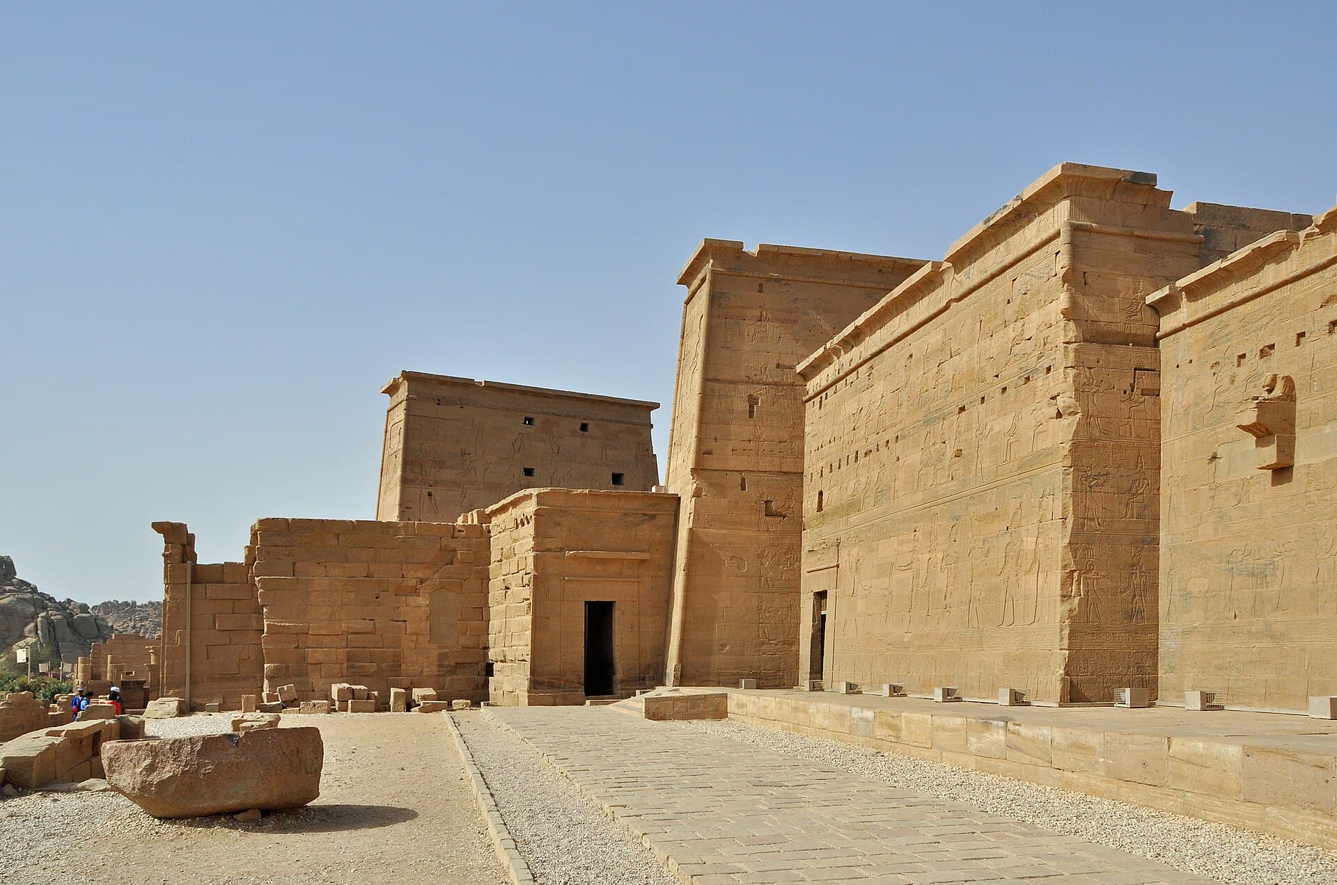
Kom Ombo comes next, on a bend of the river about 45 kilometres north of Aswan, and it is the strangest of the four. It was built for two gods at once — Sobek the crocodile god and Haroeris, a form of Horus the Elder — so it is doubled down the middle: two entrances, two sanctuaries, two of almost everything, with a crocodile museum beside it. Philae, the last, stands on an island near Aswan and is reached by motorboat; it is a late temple to Isis that was cut into blocks and rebuilt on higher ground when the dams raised the water around it.
Why is Egypt called the gift of the Nile?
The phrase is Herodotus's, and it is close to literal. Egypt is desert apart from a green strip a few kilometres wide either side of the river, plus the delta. Nearly the entire population lives on that strip.
Before the High Dam at Aswan, the river flooded every year and left silt behind, which is what made the strip fertile. The dam ended the flooding, which stopped the destruction and also stopped the silt. It is one of the more consequential trade-offs in modern Egyptian history, and you can see both sides of it from the water.
The green strip, the delta and where Egyptians live
Look at Egypt from above and the shape the river makes is unmistakable: a thin green line running the length of the country, swelling into a broad triangle of farmland at the top where the river fans out to meet the sea. That triangle is the Nile Delta, below Cairo and reaching the coast between Alexandria and Port Said, and it holds a large share of the country's farmland and people. Everything either side of the line and the triangle is desert.
The practical consequence is that Egypt is one of the most concentrated countries on earth. The vast majority of Egyptians live within a short walk of the Nile or the canals fed from it, because there is nowhere else with water. Cairo sits at the hinge, where the single valley opens into the delta — the point the ancient Egyptians treated as the join between Upper and Lower Egypt, the two halves a pharaoh united.
For a visitor this is why the country feels the way it does. The moment a train or a cruise boat leaves the green, there is nothing: sand to the horizon on both sides. The temples, the cities and the farms are all strung along the same thread of water, which is exactly why a river journey shows you so much of Egypt in so few kilometres. You are travelling the one line the whole country is built along.
The river as ancient Egypt's highway
The Nile was not just what watered Egypt; it was how Egypt moved. In a country that is a single thread of settlement through desert, the river was the road, and nearly everything heavy travelled on it. The clearest surviving proof is at Aswan, where a fenced quarry in the middle of the modern town holds a single enormous obelisk still attached to the bedrock, abandoned partway through cutting when a crack opened along its length.
That quarry explains a great deal of what visitors look at further north. The granite for the obelisks at Karnak, for the colossi of Ramesses, and for sarcophagi inside the pyramids came from here and travelled downriver — in some cases the better part of a thousand kilometres. Moving a block of that size overland was effectively impossible; floating it on the current was not. The river did the work.
It also set the direction of trade and power. Because the current runs north and the wind runs south, a boat could carry goods downstream to the delta on the flow and return upstream under sail, without fighting either one. That two-way street is part of why a single kingdom could hold together along more than a thousand kilometres of valley for so long. The Nile was the thing that made a long, thin country into one country.
The First Cataract at Aswan: where the river changes
Aswan marks a real boundary, and the boundary is geological before it is anything else. North of the town the Nile runs through sandstone and, further north, limestone, in a broad floodplain. At Aswan it hits granite, and the hard rock breaks the river into channels around islands. That is the First Cataract: a stretch of rapids and rock that stopped boats and marked, for the ancient Egyptians, the southern frontier of their world.
The same granite is the reason both of Aswan's dams were built here rather than anywhere else, and the reason the water runs clearer and the light reads harder and cleaner than it does at Luxor. It is also the reason Aswan feels different: quieter, less hurried, and less organised around processing coach groups than the sites further north. Culturally this is where Egypt meets Nubia, and plenty of people here speak Nubian at home alongside Arabic.
For anyone sailing the river, the cataract is the practical end of the line. A standard cruise turns around at Aswan because the granite and the dams stop it going further south by water. Beyond that point the river has become Lake Nasser, and that is a separate kind of trip.
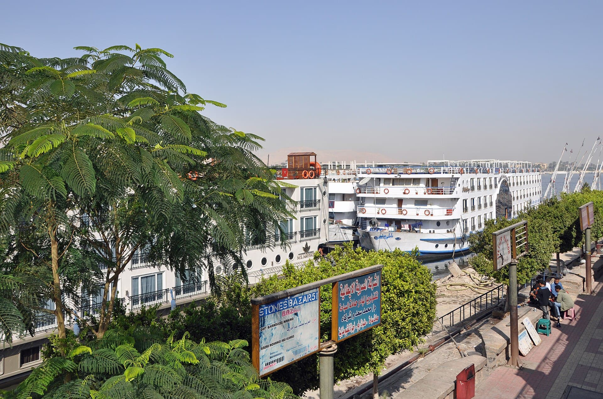
Cruising the river: the boats, the direction and the lock
The boats that carry passengers are flat-bottomed river cruise ships, built shallow for a shallow, slow river. On the standard Luxor-to-Aswan route the running order southbound is Luxor and Karnak, then a full sailing day, then Edfu, then Kom Ombo, and finally Aswan and Philae; northbound it runs the other way. Because the sights are packed into 200 kilometres, a great many boats work the same short stretch and tend to arrive at each mooring in the same window.
That crowding produces the one delay nobody can plan around: the lock at Esna, between Luxor and Edfu. A lock is a single gated chamber that raises or lowers boats between two levels of water, and only so many hulls fit in it at once. When a whole fleet reaches it together, they go through in turns, and the wait can run from an hour to an entire evening. There is no overtaking a queue of cruise boats, so you take your place in it.
Direction is the other thing worth understanding before you book. Sailing from Luxor south to Aswan is going upstream, against the current, so it takes longer and is usually the four-night itinerary; the northbound Aswan-to-Luxor leg runs with the current and is often sold as three nights. The temples are the same either way. What differs is the number of nights and, at the margins, the price.
Sailing without an engine: feluccas and dahabiyas
There is an older way to travel the river, and it survives because of a quirk of the wind. The prevailing wind on this stretch blows from the north — that is, against a river flowing north — so a sailing boat can go upstream under sail and simply drift back down on the current. That is exactly how the ancient Egyptians moved, and it is why the hieroglyph for travelling south was a boat with a sail up, and for travelling north a boat with the sail down.
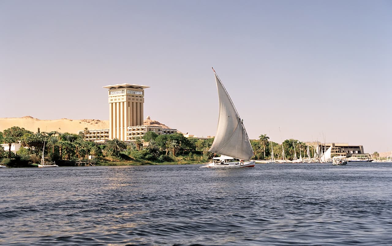
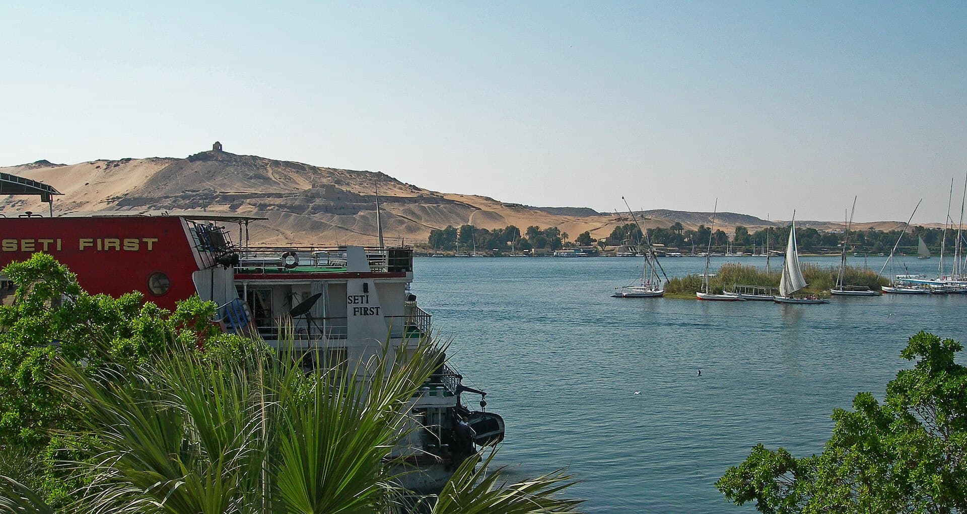
The felucca is the small version: a lateen-rigged open sailing boat with no engine, taken for two or three hours at a time, usually around the islands at Aswan in the late afternoon when the heat drops. It is slow, and if the wind dies you sit, which is the point and also the frustration, depending on the passenger. The dahabiya is the larger, overnight version: a shallow, flat-bottomed sailing boat with a handful of cabins, carrying one small group rather than the passenger list of a cruise ship, and moving at the pace the wind allows.
Neither is a way to see the river faster; both are a way to see it slower and quieter, closer to the water and to the way it was travelled for most of its history. If ticking off temples on a schedule is the aim, a motorised cruise does more in less time. If the river itself is the reason you came, the boats that use the wind are the ones that feel like the Nile.
When to sail, and why
The workable season for a Nile cruise is October to April, and if you can choose freely, March or October. That is roughly the same answer as for Egypt as a whole, but the reasoning on a boat is not. A cruise gives you shade, air conditioning and a cabin an hour from wherever you are standing, so summer heat hurts you at the temples, not on board. Cold, when it comes, hurts you on deck in the evening — which is precisely where you were planning to spend your nights.
That trade-off is why the shoulder months win. In the deep winter the sites are comfortable but the evenings on deck can be genuinely chilly once the sun goes. In high summer the deck is glorious at night and the temples are punishing by ten in the morning. October and March sit in the middle: warm enough to enjoy the water, mild enough to walk a temple without it becoming an endurance test.
Lake Nasser and the High Dam
South of Aswan the river widens into Lake Nasser, a reservoir created by the High Dam that extends into Sudan. Abu Simbel sits on its western shore, and the temples there were cut into blocks and moved uphill so the rising water would not drown them.
A small number of cruises sail Lake Nasser rather than the river itself. They are quieter and see fewer people, and they reach temples that are otherwise a long drive.
What the High Dam did to the river
As a sight, the High Dam is dull — a broad embankment with a viewpoint and a long view over the lake. As a piece of history it changed Egypt more than any structure since antiquity. Built through a Soviet-Egyptian partnership, it ended the annual flood, gave year-round irrigation and multiple harvests, supplied much of the country's electricity for decades, and buffered both drought and destructive floods.
The cost came with the benefit. The dam holds back the silt that fertilised the valley for thousands of years, so farming now leans heavily on manufactured fertiliser; the delta coast erodes without new sediment reaching it; salt has built up in some soils; and the reservoir loses a great deal of water to evaporation in the desert heat. It also drowned Nubia. The temples along that reach got international rescue campaigns and a great deal of attention; the villages got resettlement, and many Nubian families were moved north, some to the area around Kom Ombo.
If you want to understand the trade-off from the water, the clearest place to see both sides is the boat crossing to Philae. The reservoir behind you tells you what the water did; the temple ahead of you, standing on a rebuilt island, tells you what it cost to save one small part of what the water covered.
Common questions
Which countries does the Nile flow through?+
Its basin covers around eleven countries in east and north-east Africa. The main course that visitors think of runs through Uganda, South Sudan, Sudan and Egypt, with the Blue Nile joining from Ethiopia at Khartoum.
Can you cruise the whole Nile?+
No. Tourist cruising is effectively limited to the stretch between Luxor and Aswan, plus a separate operation on Lake Nasser. The rest of the river is not set up for passenger cruising and parts of it cross borders.
Is the Nile safe to swim in?+
Not advisable. Bilharzia is present in still and slow-moving water in parts of the river, and river traffic near the cruise moorings is heavy. Boats have pools for a reason.
Where does the Nile start?+
There is no single agreed source. The White Nile is usually traced to the Lake Victoria basin and, further back, to headstreams in Rwanda or Burundi. The Blue Nile rises at Lake Tana in Ethiopia. Which one counts as the source is why the river's length is disputed.
Why does the Nile flow north when north is up on the map?+
Because water runs downhill, not up the page. The Nile rises in the high country of east and central Africa and falls towards the Mediterranean, which happens to lie to the north. Up on a map only means north, not uphill.
Which part of the Nile do most travellers actually see?+
The roughly 200 kilometres between Luxor and Aswan. That short stretch holds the riverbank temples — Esna, Edfu, Kom Ombo and Philae — and is shallow and slow enough for cruise boats. North of Luxor the river runs through farmland and cities, and almost nobody cruises it.
Which direction should I cruise, Luxor to Aswan or the other way?+
You see the same temples either way. Luxor to Aswan is upstream, against the current, and is usually the four-night sailing; Aswan to Luxor runs with the current and is often the three-night one. Choose on the number of nights and the price rather than the scenery.
Why do cruise boats sometimes wait for hours near Esna?+
Because of the lock at Esna, between Luxor and Edfu. A lock moves boats between two water levels a few hulls at a time, and so many cruise boats work this short stretch that they reach it together and queue. The wait can run from about an hour to a whole evening, and no operator can schedule around it.
Official sources
Entry rules, opening hours, security advice and exchange rates all move. Check them at the source, not here.
Written and checked by the Nile Trip Guide editorial team · Last reviewed . Entry rules, prices and opening hours change — check anything critical against the official sources linked on this page.
Three nights sailing north from Aswan to Luxor, taking in Philae, Kom Ombo, Edfu, the Valley of the Kings and finally Karnak. Full board on board, and the sightseeing runs as a shared group of about fifteen.
Four nights sailing south from Luxor to Aswan: Karnak and Luxor temples on the first afternoon, the Valley of the Kings, Edfu, Kom Ombo and Philae. Full board throughout, with sightseeing in a shared group of about fifteen.